
Airport NOC & Height Clearance in India: Complete Guide to AAI, Air Force, Army & MOD NOC
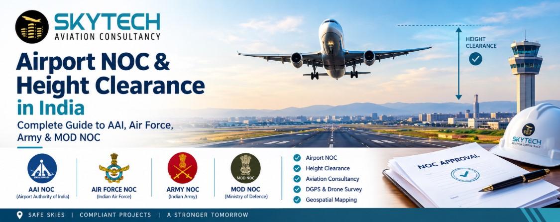
Airport Height Clearance in India is a mandatory No Objection Certificate (NOC) from the Airports Authority of India (AAI) that confirms your proposed building height will not obstruct aircraft flight paths. Any construction near an airport, air force station, army aviation base or helipad needs an Airport NOC for building construction before work starts. Skytech Aviation, a leading Airport NOC consultant in India and aviation consultancy firm, handles the full process: AAI NOC for height clearance, Air Force NOC, Army NOC, MOD NOC, Helipad NOC, plus the DGPS survey, drone survey and Elevation Certificate for Airport NOC that every application needs.
- Who needs it: builders, developers, industrial owners, telecom tower companies, hospitals, schools and individual plot owners near airports or defence airfields.
- Who issues it: AAI for civil airports; Indian Air Force, Army, Navy and Ministry of Defence (MOD) for defence airfields; HAL, private and state government airports for their own zones.
- What it needs: site coordinates in WGS-84, site elevation above mean sea level (AMSL), proposed building height and a site plan.
- Who can help: an aviation NOC consultant with geospatial surveying capability, such as Skytech Aviation Consultancy (Pune, Navi Mumbai, New Delhi and Gorakhpur).
Services Covered in This Guide
|
Service |
What it delivers |
|---|---|
|
Airport NOC Consultant in India |
End-to-end NOC application, tracking and objection handling |
|
Aviation NOC Services in India |
AAI, Air Force, Army, Navy, HAL, MADC and private airport NOCs |
|
Airport NOC for Building Construction |
Height clearance for residential, commercial and industrial projects |
|
Air Force / Army / MOD NOC Consultant |
Defence clearances near military airfields and stations |
|
Elevation Certificate for Airport NOC |
WGS-84 coordinates and AMSL elevation by DGPS and Total Station |
|
DGPS, Drone, Topographical and Geospatial Surveying |
Accurate survey data, contour maps, LiDAR and 3D models |
|
Helipad NOC Consultant |
Clearances for helipad and airport development |
What Is Airport Height Clearance and Airport NOC in India?
An Airport NOC is a written approval that your building, tower or structure at a given location and height is safe for air navigation. Airport Height Clearance in India protects aircraft during take-off, landing and approach by controlling the height of structures around airports. The permission is checked against the airport's Obstacle Limitation Surfaces (OLS) and the Colour Coded Zoning Map (CCZM) prepared for that airport.
In simple terms, every plot near an airport has a maximum permitted height above mean sea level. If your proposed top elevation stays under that limit, the NOC is granted. If not, the authority may refuse the NOC or ask you to reduce the height.
Why Aviation NOC Services in India Matter
- Legal compliance: local municipal bodies and development authorities often ask for the AAI NOC before sanctioning building plans.
- Safety: obstacles near runways, approach funnels and take-off climb surfaces put flights at risk.
- Project protection: building without a valid height clearance can lead to notices, stop-work orders or even demolition of the extra floors.
- Finance and sale: banks, buyers and RERA-linked projects prefer land and buildings with a valid Airport NOC.
Which Airports Issue the NOC?
|
Authority |
Typical NOC area |
|---|---|
|
Airports Authority of India (AAI) |
Civil airports and civil enclaves |
|
Indian Air Force (IAF) |
Air Force stations and airfields |
|
Indian Army / Army Aviation |
Army aviation bases and military stations |
|
Indian Navy |
Naval air stations |
|
HAL, Private airports, State Government airports, MADC |
Their own airport zones |
Skytech Aviation Consultancy is specialised in obtaining approvals, permissions and NOCs from all of these agencies, which makes it a single-window Aviation NOC consultant for builders and developers.
Airport NOC for Building Construction and AAI NOC for Height Clearance
You need an Airport NOC for building construction whenever your plot lies in the height-restricted zone around an airport, which generally means within roughly 20 km of the airport reference point. The AAI NOC for height clearance is applied for online and decided after the authority checks your site coordinates, ground elevation and proposed building height against the airport's zoning map.
Projects That Commonly Need Airport Height Clearance
- Residential towers, apartments, villas and township projects
- Commercial complexes, malls, hotels and hospitals
- Factories, warehouses and industrial sheds
- Telecom towers, chimneys, wind turbines and transmission structures
- Schools, colleges and government buildings
- Heliport and helipad construction near city airspace
What the AAI Checks
- Location: the exact latitude and longitude of the site in the WGS-84 system.
- Elevation: the site elevation above mean sea level (AMSL), taken from a DGPS or Total Station survey.
- Proposed height: the building height above ground level (AGL) and the final top elevation (AMSL).
- Distance and bearing: how far the site is from the runway and which surface of the OLS it falls under.
- Defence stations nearby: whether an Air Force, Army or Navy NOC is also required.
Common Reasons for Delay or Rejection
- Wrong or approximate coordinates and elevation taken from Google Earth instead of a certified survey
- Mismatch between the Elevation Certificate for Airport NOC and the submitted drawings
- Proposed top elevation above the permissible height for that zone
- Missing documents, unsigned forms or unclear site plans
A professional Airport NOC consultant in India avoids these errors by preparing correct survey data first and then filing the application. Skytech Aviation has delivered 1500+ projects across 40+ locations in India and offers the Building Construction height clearance NOC from the Indian Air Force, Army, Navy, Airports Authority of India, HAL, private airports, state government airports and MADC.
Air Force NOC Consultant, Army NOC Consultant and MOD NOC Consultant
If your site is near a defence airfield, military station or defence land, you need an Air Force NOC, Army NOC or Ministry of Defence (MOD) NOC in addition to, or instead of, the civil AAI NOC. Defence authorities protect flying operations, radar, communication links and security zones, so their rules and processes are separate from civil aviation.
|
NOC Type |
When it is required |
How a consultant helps |
|---|---|---|
|
Air Force NOC |
Construction near IAF airfields, air bases and technical areas |
Prepares survey data, files the application and follows up with the station |
|
Army NOC |
Sites close to Army cantonments, military stations, ranges and Army aviation bases |
Handles local military authority liaison and objections |
|
MOD NOC |
Projects near defence land or establishments needing Ministry-level view |
Compiles documents, replies to queries and tracks the file |
Why Hire an Air Force NOC Consultant or Army NOC Consultant
- Defence NOC rules differ by station, so local knowledge saves months.
- Applications need exact coordinates, distances from defence boundaries and attested site plans.
- A consultant keeps communication with the station authority professional and on record.
- One consultant can manage AAI, Air Force, Army and MOD NOC together when a plot falls in overlapping zones.
Skytech Aviation Consultancy works as an Air Force NOC consultant, Army NOC consultant and MOD NOC consultant, with experience in obtaining permissions from the Indian Air Force, Army, Navy, HAL, state governments and private airports across India.
DGPS, Drone, Topographical and Geospatial Surveying Services in India
Every Airport NOC application starts with accurate survey data: DGPS or Total Station for coordinates and elevation, and drone, LiDAR or topographical surveys for the surrounding terrain and obstacles. Wrong survey data is the single most common reason NOC files get queries or rejection.
|
Survey Service |
What it gives you |
Used for |
|---|---|---|
|
DGPS Survey Services in India |
Centimetre-level latitude, longitude and elevation |
Site coordinates in WGS-84 and AMSL for the NOC |
|
Drone Survey Services in India |
Aerial imagery, orthomosaics, 3D models, contours |
Large sites, corridors, towers and fast mapping |
|
Topographical Survey Services |
Contours, spot levels, boundaries and existing features |
Design, planning and obstacle assessment |
|
Geospatial Surveying Services |
GPS, LiDAR, remote sensing and GIS mapping |
Detailed landscapes, building details, infrastructure 3D models |
|
Elevation Certificate for Airport NOC |
Signed certificate with WGS-84 coordinates and site elevation AMSL |
Mandatory attachment for AAI and defence NOC |
Elevation Certificate for Airport NOC
An Elevation Certificate for Airport NOC states the geographic coordinates of your plot in the WGS-84 system and the site elevation above mean sea level. Skytech Aviation prepares it using modern equipment such as DGPS and Total Station, so the numbers match what airport authorities expect.
Drone Survey and Topographical Survey Benefits
- Faster data capture than a traditional ground survey on large or difficult sites
- High-accuracy contour maps and digital terrain models
- Safer access to rooftops, slopes, towers and restricted areas
- Obstacle Survey and aeronautical charts for helipad and airport planning
- Ready-to-use drawings for architects, engineers and authorities
Skytech Aviation brings together DGPS, contour, LiDAR and GIS capability, so one team can deliver both the survey and the NOC, with no gaps between the two.
Helipad NOC Consultant and Aviation Consultancy Services
A Helipad NOC consultant helps you get approval to build and operate a helipad or small airstrip, from feasibility study to final regulatory clearance. Helipads on hospitals, hotels, corporate buildings, industrial plants and government sites need clearance from the airspace authorities and the local administration before construction.
Helipad and Airport NOC Support Includes
- Site feasibility and obstacle assessment
- Obstacle Survey, Topographical Survey and aeronautical charts
- NOC for construction of helipads and airports from various government agencies
- Flight and helicopter planning for fixed-wing and rotary-wing aircraft
- Permissions for drones, hot air balloons, paragliding and similar operations
Aviation Consultancy Services for Infrastructure
Skytech Aviation provides aviation consultancy services to airlines, business aviation, MRO, airports, regulators and the real estate industry. Its Pune-based team, with offices in Navi Mumbai, New Delhi and Gorakhpur (UP), combines regulatory knowledge with survey technology, so clients get one point of contact for NOC, survey and flight-planning needs.
How to Get an Airport NOC for Height Clearance: Step-by-Step Process
The Airport NOC process has six steps: check the zone, survey the site, prepare documents, file the application, answer queries and receive the NOC.
- Check the zone. Find out which airport or defence station governs your plot and whether AAI, Air Force, Army, Navy or MOD clearance applies.
- Survey the site. Get a DGPS or Total Station survey for WGS-84 coordinates and site elevation AMSL, and issue the Elevation Certificate for Airport NOC.
- Prepare the documents. Collect the site plan, building drawings, ownership papers and the proposed height details.
- File the application. Submit the application on the authority's official portal or channel with all attachments.
- Handle queries. Reply to objections, clarifications or requests for revised heights from the airport or defence authority.
- Receive and use the NOC. Submit the approved Airport NOC to your municipal or development authority, and stay within the approved height.
Documents Usually Required
|
Document |
Purpose |
|---|---|
|
Site plan and layout with plot boundary |
Shows exact location and area |
|
Building plan with proposed height details |
Confirms height AGL and top elevation AMSL |
|
Elevation Certificate (WGS-84 coordinates and AMSL) |
Verifies site position and ground level |
|
Land ownership or title papers |
Proves the applicant's right on the site |
|
Applicant ID and authorisation letter |
Allows the consultant to act on your behalf |
|
Earlier NOC, if any |
Needed for revisions or height changes |
How Long Does It Take?
Timelines depend on the airport, the authority and the quality of the first submission. A complete application with accurate survey data usually moves faster than one that needs corrections. Defence NOCs can take longer than civil AAI NOCs because of the extra internal checks. Rules, fees and validity periods are set by the authorities and may change, so always confirm the latest requirements with your consultant before filing.
Why Choose Skytech Aviation as Your Airport NOC Consultant in India
Skytech Aviation Consultancy is a Pune-based aviation and infrastructure consultant that combines NOC approvals with in-house geospatial surveying, so you do not need separate vendors.
|
Strength |
Detail |
|---|---|
|
Experience |
8+ years of excellence in aviation NOC services |
|
Track record |
1500+ projects delivered |
|
Coverage |
Served 40+ locations PAN India |
|
Offices |
Pune, Navi Mumbai, New Delhi and Gorakhpur (UP) |
|
NOC range |
AAI, Indian Air Force, Army, Navy, HAL, private airports, state government and MADC |
|
Survey capability |
DGPS, Total Station, contour, LiDAR, GIS and drone survey |
|
Sectors served |
Airlines, business aviation, MRO, airports, regulators and real estate |
What Clients Get
- One team for NOC, Elevation Certificate, survey and drawings
- Accurate, authority-ready data that reduces queries
- Support from feasibility to final clearance
- Clear communication and file tracking until the NOC is issued
Explore the full Aviation NOC Guide, Services and Our Clients pages on the Skytech Aviation website.
Frequently Asked Questions
What is Airport Height Clearance in India?
Airport Height Clearance is an NOC from the airport authority, mainly AAI, confirming that your building height will not affect flight safety near the airport.
Do I need an Airport NOC for building construction?
Yes, if your plot falls inside the height-restricted zone of a civil or defence airport. Many municipal bodies will not approve plans without the NOC.
Who is the best Airport NOC consultant in India?
Choose a consultant that offers NOC filing and surveys together. Skytech Aviation Consultancy provides Airport NOC, AAI NOC, Air Force NOC, Army NOC, MOD NOC, DGPS survey and drone survey from one team, with 1500+ projects delivered.
What is an Elevation Certificate for Airport NOC?
It is a certificate giving your site's WGS-84 coordinates and elevation above mean sea level, prepared from a DGPS or Total Station survey and attached to the NOC application.
When is an Air Force NOC, Army NOC or MOD NOC needed?
When your site is near an Air Force station, Army establishment, defence land or other military installation. An Air Force NOC consultant, Army NOC consultant or MOD NOC consultant manages these approvals.
What are DGPS Survey Services in India used for?
DGPS gives highly accurate coordinates and elevation. It is used for the Airport NOC application, boundary marking, construction layout and engineering projects.
Why use Drone Survey Services in India for NOC projects?
Drone surveys capture large or hard-to-reach sites quickly and produce contours, orthomosaic maps and 3D models for planning and obstacle assessment.
Can a consultant also help with a Helipad NOC?
Yes. A Helipad NOC consultant supports feasibility, obstacle survey, charts and permissions from the relevant government agencies for helipads and airports.
What is the difference between a Topographical Survey and a Geospatial Survey?
A topographical survey maps ground levels, contours and features of a site. Geospatial surveying is broader and uses GPS, LiDAR, remote sensing and GIS to build detailed maps and 3D models.
Conclusion: Get Your Aviation NOC Without Delays
To get Airport Height Clearance in India without delays, start with an accurate DGPS-based Elevation Certificate, apply to the right authority, and work with an experienced Aviation NOC consultant. Skytech Aviation offers Airport NOC consultant services, Aviation NOC services in India, AAI NOC for height clearance, Air Force, Army and MOD NOC, helipad approvals, topographical, drone and geospatial surveys under one roof.
Contact Skytech Aviation Consultancy
- Website: www.skytechaviation.in
- Pune Office Phone: +91 88304 50611, +91 93090 54883
- Email: skytechinfra2018@gmail.com
- Offices: Pune, Navi Mumbai, New Delhi, Gorakhpur (UP)
Appointments are recommended before office visits. Contact Skytech Aviation for a free first discussion on your Airport NOC for building construction, helipad NOC or survey requirement.

 English
 Arabic
 French
 Spanish
 Portuguese
 Deutsch
 Turkish
 Dutch
Dutch
 Russian
 Romaian
 Portuguese (Brazil)
 Greek
Greek