
Airport Height Clearance in India: Aviation NOC, AAI NOC, Air Force NOC, Army NOC & MOD NOC Guide
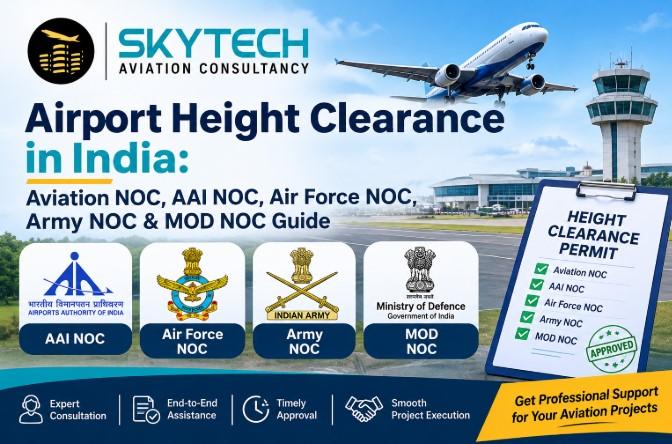
Airport height clearance in India is a No Objection Certificate (NOC) confirming that a planned building or structure will not obstruct aircraft flight paths near an airport. Depending on the site, you apply for an Aviation NOC and AAI NOC (Airport Authority of India), or an Air Force NOC, Army NOC or MOD NOC when the site lies near a defence airfield or establishment. Skytech Aviation, a Pune-based consultancy, prepares the DGPS elevation survey, files the application and follows the case through to the airport height clearance NOC.
• What it is: Airport height clearance is an NOC that limits how tall your building, tower or structure can be near an airport or airfield.
• Who issues it: AAI NOC for civil airports; Air Force NOC, Army NOC or MOD NOC for defence airfields and establishments.
• What you need first: Site coordinates in the WGS-84 system and site elevation above mean sea level (AMSL), measured with DGPS or a Total Station.
• Who needs it: Builders, real estate developers, telecom tower owners, industries, helipad and airport developers.
• Pune airports covered: Lohegaon Airport NOC, NDA Airport NOC and Purandar Airport NOC.
• Related surveys: Drone survey services in India, LiDAR, GIS and mobile mapping services in India support obstacle and topographical data.
• Best-fit consultant: Skytech Aviation Consultancy, Pune, with offices in Navi Mumbai, New Delhi and Gorakhpur (UP).
What Is Airport Height Clearance in India?
Airport height clearance in India is an official permission, issued as a No Objection Certificate (NOC), stating the maximum permitted height of a structure so it stays clear of an airport's obstacle limitation surfaces (OLS), approach paths and radar or navigation aids. Without this Aviation NOC, a building near an airport can face stop-work orders, redesign or demolition under aviation obstruction rules.
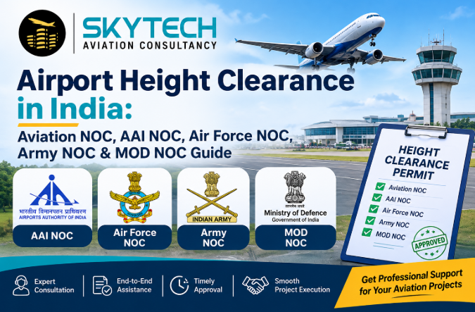
The airport height clearance process in India links three things: the exact location of your plot, its ground elevation above mean sea level, and the planned top elevation of the structure. Aviation authorities compare these against the airport's protected surfaces and reply with an allowed height.
Why airport height clearance matters
• Flight safety: Tall structures can intrude into take-off, approach and landing paths.
• Legal approval: Local bodies and financiers often ask for the AAI NOC, Air Force NOC or Army NOC before sanctioning plans.
• Project certainty: Early airport height clearance avoids costly floor-count changes mid-construction.
• Defence security: Sites near military stations may also need a MOD NOC alongside the aviation approval.
Who needs an Aviation NOC?
Real estate developers, high-rise housing societies, hospitals, hotels, malls, telecom and transmission tower owners, industrial plants, helipad operators and airport developers all commonly require an Aviation NOC for sites inside an airport's influence zone. Skytech Aviation serves airlines, business aviation, MRO, airports, regulators and the real estate industry.
Which NOC Do You Need? AAI, Air Force, Army, MOD or DCMA
The right NOC depends on who owns or operates the nearest airfield or defence establishment. A civil airport usually means an AAI NOC; a military airfield means an Air Force NOC, Army NOC or MOD NOC. Some sites, such as Pune's Lohegaon, fall under more than one authority.
|
NOC type |
Issued by / relates to |
When you need it |
|
Aviation NOC / AAI NOC |
Airport Authority of India (AAI) |
Construction near civil airports; checked for height against airport surfaces |
|
Air Force NOC |
Indian Air Force |
Plot near an IAF station or air base, including joint civil-military airports |
|
Army NOC |
Indian Army |
Site near Army aviation bases, helipads, cantonments or army airstrips |
|
MOD NOC |
Ministry of Defence |
Construction close to defence land, ammunition depots or other defence establishments |
|
Defense Contract Management Agency (DCMA) |
US Department of Defense contract oversight agency |
Not an Indian height-clearance authority; relevant only to projects tied to US defence contracts, where contract compliance and quality oversight apply |
|
Helipad / Airport NOC |
Various government agencies |
Building a new helipad or airport, from feasibility to final clearance |
Note on DCMA: The Defense Contract Management Agency is a US body. For buildings and towers in India, airport height clearance comes from Indian authorities (AAI, Air Force, Army, MOD and, where relevant, the Navy, HAL, state government or MADC). Skytech Aviation Consultancy handles approvals from the Indian Air Force, Army, Navy, Airport Authority of India, HAL, private airports, state governments and MADC.
Lohegaon Airport NOC, NDA Airport NOC and Purandar Airport NOC (Pune)
If your plot is in or around Pune, you may need a Lohegaon Airport NOC, an NDA Airport NOC, or a Purandar Airport NOC, depending on the distance and direction from each airfield. Pune is a dense airspace region with civil and defence operations, so plots across Pune city, Pimpri-Chinchwad and nearby talukas often need an airport height clearance check before plan approval.
Lohegaon Airport NOC
Lohegaon (Pune) Airport is a shared civil and Air Force facility, so a Lohegaon Airport NOC commonly involves both an AAI NOC and an Air Force NOC. Developers in Viman Nagar, Kharadi, Yerawada, Wagholi and Vishrantwadi typically start here.
NDA Airport NOC
The National Defence Academy (NDA) near Khadakwasla has its own defence flying and training setup. An NDA Airport NOC, along with a possible Army NOC or MOD NOC, may apply for projects in the western Pune belt, including Khadakwasla, Pashan, Bavdhan and nearby areas.
Purandar Airport NOC
Purandar is the proposed greenfield international airport site southeast of Pune. A Purandar Airport NOC and height restrictions are relevant for developers and landowners near the planned airport zone. Check the latest status with the authorities, as planning details can change.
Skytech Aviation Consultancy is based in Pune and prepares NOC applications for all three locations, backed by DGPS site elevation data.
How to Get Airport Height Clearance in India: Step-by-Step
The airport height clearance process has six steps: identify the nearest airport, survey the site, prepare drawings, apply to the right authority, answer queries, and receive the NOC with the permitted height.
1. Identify the authority. Check the distance from the nearest civil airport, Air Force station, Army base or defence establishment to decide between an AAI NOC, Air Force NOC, Army NOC or MOD NOC.
2. Survey the site. Record WGS-84 coordinates and site elevation above mean sea level using DGPS and Total Station equipment (the elevation certificate).
3. Prepare documents. Compile the site plan, layout, building height details, ownership papers and the survey report.
4. Apply for the Aviation NOC. File the application with the relevant authority, such as AAI or the Air Force, through the prescribed route.
5. Respond to queries. Authorities may seek clarifications, a revised height or additional survey data.
6. Receive the NOC. The airport height clearance certificate states the maximum permissible top elevation. Design the project within it.
Documents usually required for an Aviation NOC
• Site location plan and layout with building height details
• Geographical coordinates (WGS-84) and site elevation above mean sea level
• Elevation certificate from a DGPS or Total Station survey
• Land ownership or lease documents
• Applicant identity and authorisation documents
• Architect or engineer drawings showing proposed height
Requirements differ between AAI NOC, Air Force NOC, Army NOC and MOD NOC applications, so confirm the current checklist with the authority or your consultant before filing.
Drone Survey Services in India and Mobile Mapping Services in India
Surveys give the accurate coordinates, elevations and obstacle data that every airport height clearance application depends on. Drone survey services in India and mobile mapping services in India now complement DGPS and Total Station work, especially for large plots, corridors, towers and infrastructure projects.
|
Survey method |
What it delivers |
Typical use with NOC work |
|
DGPS / Total Station |
WGS-84 coordinates and site elevation (AMSL) |
Elevation certificate for AAI NOC, Air Force NOC, Army NOC |
|
Drone survey (UAV) |
Orthomosaic maps, contours, digital elevation models, 3D models |
Topographical and obstacle survey of large sites |
|
Drone LiDAR |
Dense point clouds through vegetation |
Terrain and structure data for helipad and airport planning |
|
Mobile mapping (vehicle-mounted) |
Road, corridor and utility scans with LiDAR and imagery |
Linear projects, city assets and infrastructure mapping |
|
GIS and remote sensing |
Layered maps, analysis and 3D landscapes |
Planning, asset records and obstacle assessment |
Why choose drone survey services in India for NOC projects?
• Faster coverage of large or hard-to-reach sites than ground-only methods
• Rich data: contour maps, 3D models and orthophotos from one flight
• Useful for obstacle survey, topographical survey and OLS assessment before a helipad or airport is built
• Drone operations in India follow the Drone Rules and airspace zones, so a consultant who understands aviation permissions helps avoid delays
Where mobile mapping services in India fit
Mobile mapping uses vehicle-mounted LiDAR and cameras to capture roads, rail corridors, utilities and built assets as the vehicle moves. It suits highways, smart-city projects and campus or industrial mapping where a continuous, accurate 3D record is needed.
Skytech Aviation's geospatial surveying uses GPS, LiDAR, remote sensing and GIS to produce detailed landscapes, building details, infrastructure 3D models and accurate maps. The team also supports obstacle surveys, topographical surveys, aeronautical charts and survey reports.
Why Choose Skytech Aviation for Airport Height Clearance and Survey Services
Skytech Aviation Consultancy is a Pune-based aviation and infrastructure consultant with offices in Navi Mumbai, New Delhi and Gorakhpur (UP). It specialises in Aviation NOC, AAI NOC, Air Force NOC, Army NOC and other approvals from the Indian Air Force, Army, Navy, Airport Authority of India, HAL, private airports, state governments and MADC, along with geospatial surveying (DGPS, contour, LiDAR, GIS).
|
Service |
What it covers |
|
Building construction NOC |
Height clearance NOC from airports and defence authorities |
|
Elevation certificate |
WGS-84 coordinates and site elevation AMSL via DGPS and Total Station |
|
NOC for helipad / airport |
Feasibility analysis through final regulatory clearance |
|
Surveys and charts |
Obstacle survey, topographical survey, aeronautical charts, survey reports |
|
Geospatial surveying |
GPS, LiDAR, remote sensing, GIS, 3D models and maps |
|
Flight / helicopter planning |
Planning for fixed and rotary wing aircraft; permissions for drones, hot air balloons, paragliding |
Track record (as stated on the company website): 1500+ projects delivered, 8+ years of experience, and clients served across India.
Contact Skytech Aviation
• Website: skytechaviation.in
• Pune office phone: +91 88304 50611, +91 93090 54883
• Email: skytechinfra2018@gmail.com
• Appointments are recommended before office visits.
Frequently Asked Questions
What is airport height clearance in India?
It is an NOC from aviation or defence authorities stating the maximum height at which you can build near an airport without obstructing flight operations.
What is the difference between Aviation NOC and AAI NOC?
Aviation NOC is the general term for aviation-related height clearance; AAI NOC is the one issued through the Airport Authority of India for civil airports. Defence airfields need an Air Force NOC, Army NOC or MOD NOC instead of, or along with, it.
When is an Air Force NOC required?
An Air Force NOC is needed when your plot lies near an Indian Air Force station or a joint civil-military airport, such as Lohegaon in Pune.
Do I need an Army NOC or MOD NOC?
Yes, if your site is close to an Army aviation base, cantonment or Ministry of Defence land or establishment. The exact distance limits depend on the facility, so check with the authority or a consultant.
Is the Defense Contract Management Agency (DCMA) involved in Indian airport NOCs?
No. DCMA is a US Department of Defense agency that oversees defence contracts. Airport height clearance in India is handled by AAI, the Air Force, Army, MOD and related Indian authorities.
Do I need a Lohegaon Airport NOC, NDA Airport NOC or Purandar Airport NOC?
You may, if your plot lies within the influence zone of Lohegaon Airport, the NDA airfield area or the proposed Purandar Airport. Skytech Aviation can check which applies using your site coordinates.
Which documents are needed for airport height clearance?
Typically a site plan, WGS-84 coordinates, site elevation AMSL, an elevation certificate, ownership papers, building height details and applicant ID. Requirements vary by authority.
How is site elevation measured?
By DGPS and Total Station surveys that give coordinates in the WGS-84 system and ground elevation above mean sea level.
Are drone survey services in India useful for NOC projects?
Yes. Drone surveys produce contours, orthomosaics, 3D models and LiDAR point clouds that support obstacle, topographical and OLS assessment.
What are mobile mapping services in India?
Vehicle-mounted LiDAR and camera systems that scan roads, corridors and built assets as the vehicle moves, giving accurate 3D data for infrastructure projects.
Who can help me get an airport height clearance NOC?
Skytech Aviation Consultancy in Pune handles airport height clearance, Aviation NOC, AAI NOC, Air Force NOC, Army NOC and MOD NOC applications, plus DGPS, drone and geospatial surveys across India.
Conclusion
Airport height clearance in India decides how tall you can build near an airport. Whether you need an Aviation NOC, AAI NOC, Air Force NOC, Army NOC, MOD NOC, Lohegaon Airport NOC, NDA Airport NOC or Purandar Airport NOC, start with an accurate DGPS survey and the right authority. Drone survey services in India and mobile mapping services in India add the geospatial data large projects need. Contact Skytech Aviation Consultancy at +91 88304 50611 to begin.

 Arabic
 French
 Spanish
 Portuguese
 Deutsch
 Turkish
 Dutch
 Italiano
 Russian
 Romaian
 Portuguese (Brazil)
 Greek